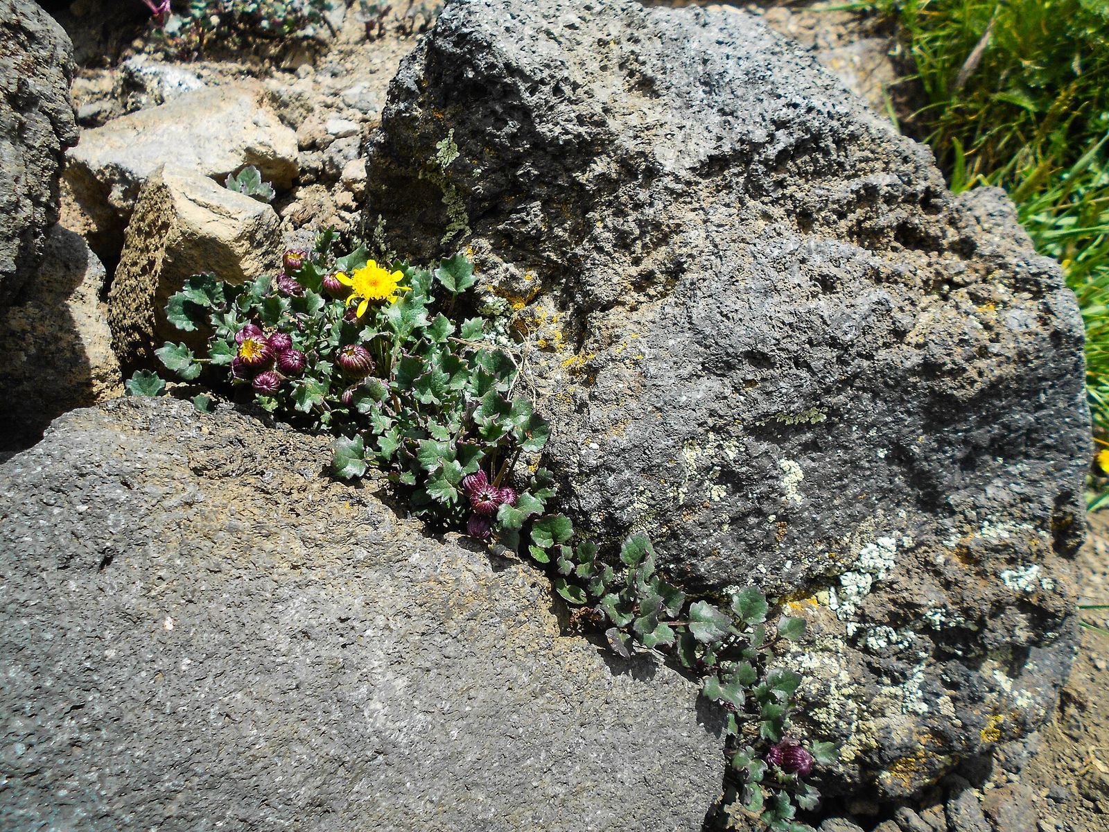
A yellow wildflower and purple buds grow from a crack between volcanic rocks on Humphreys Trail, Arizona.
Points of Interest

Humphreys Peak Trail

Arizona's rooftop, via a 5-mile climb through the clouds

(889)
Flagstaff, AZ

About

Humphreys Peak Trail climbs Arizona's highest point from the slopes of the San Francisco Peaks above Flagstaff, and the 4.8 rating across 866 reviews tells you it delivers. This is a serious mountain hike, not a rim stroll — about 5 miles one-way with long switchbacks through spruce-fir forest before you break above treeline into open, rocky, exposed terrain for the final push to the 12,633-foot summit.

What to expect

Reviewers consistently flag two things: the wind and the payoff. Above treeline the ridgeline can turn into a genuine gauntlet of 30+ mph gusts, and more than one hiker has described the last few hundred feet as a scramble into the weather rather than a walk. Plan on 5-6 hours round-trip if you're moving steadily, bring layers regardless of the forecast at the trailhead, and start early — both to beat afternoon storms and to catch the near-total lack of light pollution before dawn.

Trailhead and season

The trail starts at the end of Lot 1 at Arizona Snowbowl, with ample free parking and portable restrooms on-site (restaurant and regular restrooms at the resort itself, an easy walk away). It's a well-marked, well-traveled route, and in fall the aspen groves along the lower switchbacks turn a vivid gold that draws hikers who never intend to summit. Given the elevation, expect a snowbound trail outside summer and early fall.
Reviews (889)

See all on Google
4.8

889 reviews

Write a review
M D
M D

a month ago

Challenging 9 mile hike at 9-12k feet of elevation. Rocky terrain at the top when summitting former volcano for the last mile, watch the ankles on this one. 4.5 hours for me, could be a long day, best start early around sunrise. Incredible pine trees, squirrels, crisp air. Some portable bathrooms in gravel base parking lot. Worth seeing the highest point in AZ.

Monty Hardy
Monty Hardy

a month ago

A very beautiful but a good challenging hike. An excellent hike for a leg workout. Always make sure you take enough water.

Henry Voros
Henry Voros

11 months ago

Trail Series, Part 41 Is there a bad time to go hiking in Flagstaff? Not that I’m aware of, but Fall is certainly a GREAT time for this! Just as the days become shorter and the temperatures cool, the Aspen leaves adorn the forest with a glorious yellow hue that seems to first absorb, and then reflect, the sunshine. While not the only location for getting your Fall groove on, we found “Humphrey’s Peak Trail” (and its surrounding environs) to be generous providers of the vibes we were seeking. None of the trails that we traveled were paved and their difficulty ranged from easy to moderate. However, as you travel up the mountain you’ll find that the rocky outcroppings become more frequent and the hike becomes more strenuous. Before long you’ll find yourself at 10,000 feet, so you’ll be in much thinner air than you’re likely used to and your water/rest breaks should increase accordingly. Each trail we explored was well traveled, but the buddy system is still recommended (if for no other reason than to have someone to marvel at the beauty with). Wildlife sightings are common, but it is the rare sightings of Big Foot that are the most cherished. 😉 Ample parking and portable restrooms can be found at the trailhead located at the end of Lot 1 of the Arizona Snowbowl Resort. For those interested in traditional restrooms and/or a restaurant, both are located at the resort and an easy walk from this parking lot. If you visit Flagstaff in the Fall, please don’t find yourself “leaving” without experiencing the “leafing” all around you this time of year! And that’s…Henry’s Take. Photo credit @danavoros 📸 #flagstafffallcolors #trailseries

Gloria Haws
Gloria Haws

5 months ago

The aspen trees were yellow and stunning. A lot of people are going on the gondola ride. I chose to drive, park and walk around. My comments are about the trails that you can walk near the parking lots.

The Lugos
The Lugos

a year ago

Started at 6:20 and ended at 2:20 on the dot. Solo hiker first time up and by far my highest elevation and longest hike. Conditions were clear skies, mid 70’s on the trail, but extremely gusty at the summit. Made it to the saddle at about 8:40 and many hikers were turning back at or just past that point due to the high winds above the treeline. A couple other hikers decided to push on so I joined them to see how far I could go. There were 30mph gusts on the ridge line and were manageable up to the last false summit. Took breaks every couple minutes because that last 800ft in elevation gain is killer! At the last bit going up to the summit the wind got unbelievably rough and kept blowing me down, and thought I’d have to turn back, it was very scary! Scrambled the rest of the way to the top and took just long enough to snap a pic. Big thanks to the hikers that let me join them the rest of the way otherwise I wouldn’t have made it. Beautiful hike, trail was very rocky and lots of roots and well marked. Very challenging but not too technical. Busy trail, I was never further from another person than a 1 minute walk in either direction which brought me peace of mind without losing the peace of nature.

Powered by Google