Isis Temple
A temple of stone visible across the gorge from the South Rim
About
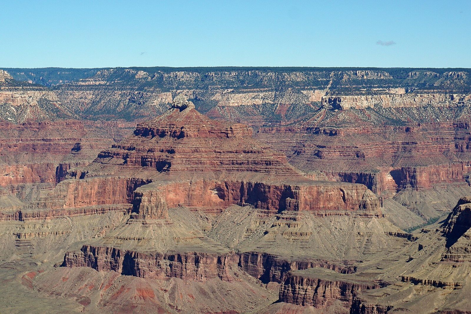
Isis Temple is one of the big free-standing buttes you pick out from the South Rim without needing a map to find it. It rises to 7,006 feet, capped by a slab of bright-white Coconino Sandstone sitting on a brownish, slope-forming layer of Hermit Shale, with Redwall limestone, Tonto Group rock, and Shinumo Quartzite stacked below down toward the Colorado River. The formation sits below the North Rim, bordered by Trinity Creek on the west and Phantom Creek to the northeast, and it's part of an uplifted block of rock roughly 3.5 miles long.
Where to see it
Isis Temple sits due north of Grand Canyon Village, about 5 miles away, which puts it square in the view from several South Rim overlooks: Mather Point, Yavapai Point, and Hopi Point all look out at it across the gorge. No trail leads to its summit from these viewpoints — it's a feature you look at, not one you hike to.
Like many of the canyon's named buttes, Isis Temple carries an Egyptian-themed name assigned by geologist Clarence Dutton in his 1882 survey of the district, part of a naming scheme he used across the canyon to convey the scale of these formations.
Best Time to View It
Mather Point and Yavapai Point are accessible year-round near Grand Canyon Village, so timing follows your broader Village-area visit.
Good to Know
- Like many of the canyon's named buttes, Isis Temple carries an Egyptian-themed name assigned by geologist Clarence Dutton in his 1882 survey of the district.
- It's part of an uplifted block of rock roughly 3.5 miles long — one of the larger formations visible from the Village-area overlooks.
- Pair a Mather Point stop with Yavapai Point nearby for two angles on the same formation.
Where to See Isis Temple
Isis Temple sits due north of Grand Canyon Village, about 5 miles away, which puts it square in the view from several South Rim overlooks: Mather Point, Yavapai Point, and Hopi Point all look out at it across the gorge. No trail leads to its summit from these viewpoints.
What You're Looking At: Isis Temple
Isis Temple is one of the big free-standing buttes you pick out from the South Rim without needing a map to find it. It rises to 7,006 feet, capped by a slab of bright-white Coconino Sandstone sitting on a brownish, slope-forming layer of Hermit Shale, with Redwall limestone, Tonto Group rock, and Shinumo Quartzite stacked below down toward the Colorado River. The formation sits below the North Rim, bordered by Trinity Creek on the west and Phantom Creek to the northeast.
Reviews
See all on GoogleNo reviews yet for this listing.