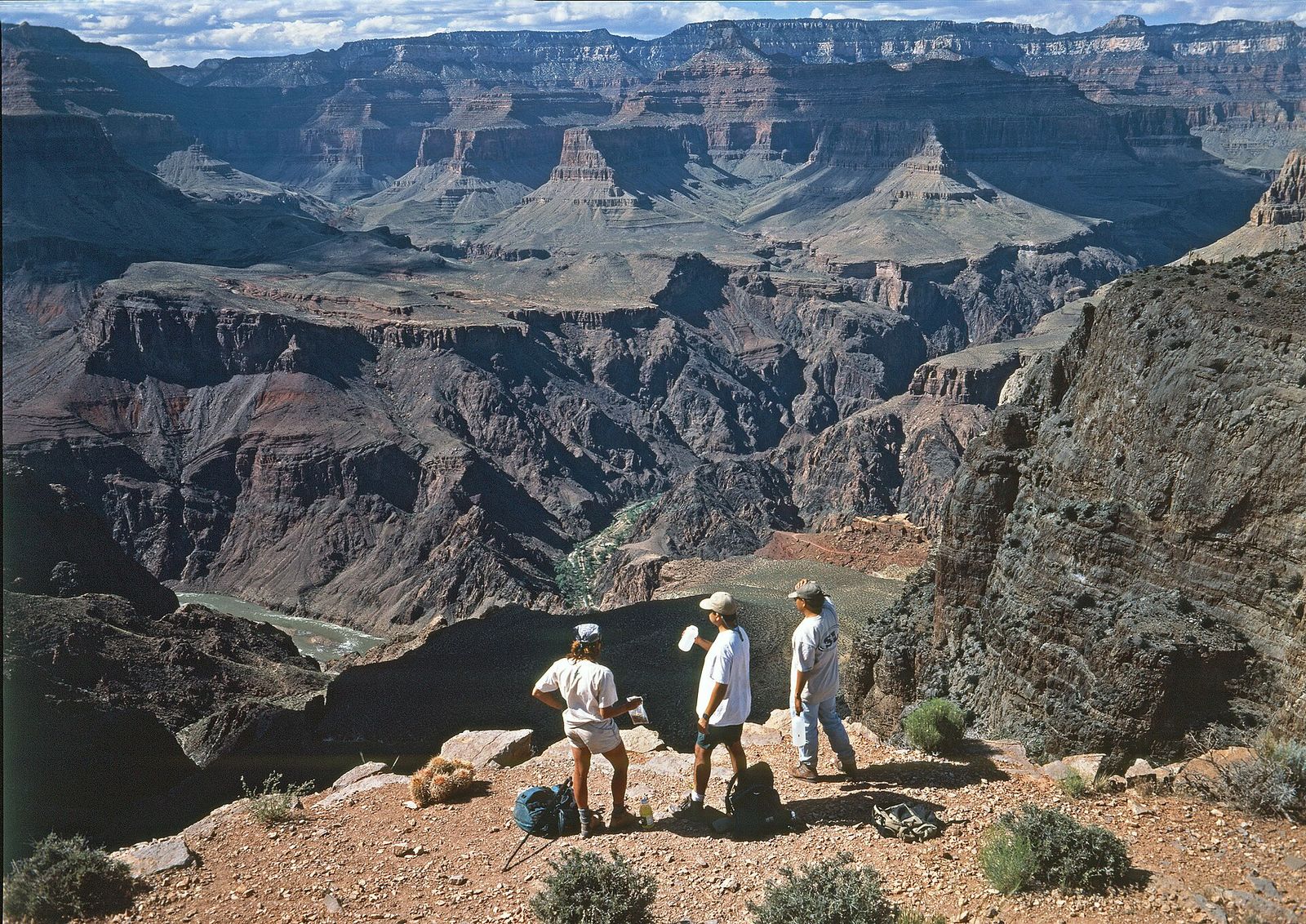
Skeleton Point
Where the South Kaibab Trail first reveals the Colorado River
About
Skeleton Point is the turnaround marker most hikers use on the South Kaibab Trail, and it earns the reputation — a rugged, sometimes gravelly stretch of switchbacks that rewards the descent with the first real view of the Colorado River from the trail. At 4.9 stars across 234 Google reviews, it's one of the highest-rated stops on the South Rim's inner canyon trails.
What to expect
This isn't a rim-side overlook you stroll to — it's a genuine hike down South Kaibab Trail, with a well-maintained but loose, gravelly surface that demands attention on the way back up. Reviewers consistently describe it as moderate-to-difficult, with round trips from the trailhead running 4-6 hours including breaks, and roughly 2,000 feet of elevation change each way. There are no water stations anywhere on this route, so hikers plan their own supply carefully. The payoff is the river itself, framed far below, plus wide views back up the inner canyon walls.
Tips from hikers
- Shade: the stretch from Cedar Ridge to Skeleton Point sits mostly in open sun — several reviewers suggest continuing just a few minutes past the point for shade and an even better river view.
- Pace yourself: the section beyond Skeleton Point toward the Tip Off is called out as the toughest part of the hike, with steady switchbacks.
- Gear: trekking poles are frequently mentioned as a help on the descent's loose footing and the long climb back out.
Most who make it this far treat it as a natural lunch stop and turnaround point rather than pushing on toward the river itself — a solid half-day goal for a strong day hiker on the South Kaibab.
Best Time to Hike to Skeleton Point
The National Park Service marks Skeleton Point as the recommended turnaround for a day hike on the South Kaibab; rangers advise checking conditions before you go, regardless of season.
Trail Tips
- No water anywhere on the South Kaibab Trail — carry everything you'll need.
- No shade along most of the route below the rim.
- Continuing past Skeleton Point toward the river adds another 5,000 feet of elevation change each way and is not something to attempt in a single day.
Getting to Skeleton Point
Reached via the South Kaibab Trailhead, which has no private vehicle parking and is served by the park's free shuttle. Getting here and back is a 6-mile roundtrip with roughly 2,040 feet of elevation change, taking most hikers 4-6 hours.
What to Expect at Skeleton Point
Skeleton Point sits three miles below the South Rim on the South Kaibab Trail, and it's the spot where the Colorado River comes into view for the first time on the descent. A short spur trail heading west from the main junction gives hikers that first look at the river far below, along with the Phantom Ranch area across the inner canyon.
Reviews
See all on GoogleNo reviews yet for this listing.