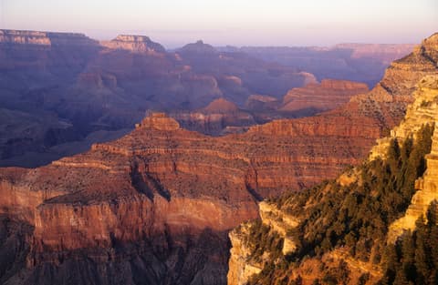
A Grand Canyon map of the South Rim looks less like a destination and more like a long piece of string, for the interactive version, see our Grand Canyon National Park Map. There is one knot tied in the middle. Desert View Drive runs 23 miles east from Grand Canyon Village. Hermit Road runs 7 miles west. The knot is the village, where the visitor center, lodges, market, and most of the parking sit a short walk or shuttle ride apart.
That shape explains most first-day confusion. Visitors expect one big overlook with a gift shop bolted to it. What they get is a strip of rim where one wrong assumption about an open road can eat half a morning. Reading the layout before arrival fixes that faster than any app.
This guide covers the South Rim only. The North Rim is a separate, seasonal trip with its own roads and services. Grand Canyon West sits on Hualapai tribal land, and Havasu Falls sits on the Havasupai Reservation. Neither one appears on the park service map at all.
Three Zones Along One Rim
The simplest way to read the South Rim is as three zones strung along the canyon edge, west to east:
- West: Hermit Road, 7 miles from the village out to Hermits Rest, with nine designated viewpoints.
- Center: Grand Canyon Village, from the visitor center and Mather Point west to the historic lodges.
- East: Desert View Drive, 23 miles from the village to Desert View and the East Entrance.
Most drivers enter through the South Entrance on Highway 64, 6 miles north of Tusayan. That road feeds into the center zone, not either end. Drivers coming from Cameron use the East Entrance at Desert View instead. That puts them at the far eastern tip of the strip.
The west zone comes with a catch that trips up plenty of first-time drivers. Hermit Road is closed to private vehicles from March 1 through November 30. The free Hermits Rest (Red) Route shuttle covers it during those months. It stops at all nine overlooks on the way out. The ride takes about 80 minutes round trip without getting off. Cars under 22 feet can drive the road only in December, January, and February.
The east zone works the opposite way. Private vehicles can reach six developed viewpoints on Desert View Drive:
- Pipe Creek Vista
- Duck on a Rock
- Grandview Point
- Moran Point
- Navajo Point, the highest overlook on the South Rim
- Desert View Point
Yaki Point is the exception, reachable only by shuttle, bicycle, or on foot. Lipan Point and Lipan Point Road are also closed to all visitors from June 22 through December 23, 2026, for maintenance.
Grand Canyon Village, From East to West
The village reads best as a walk along the Rim Trail, since that is how its pieces connect. The trail between Mather Point and the historic district is paved, with a few short sections of grade.
The Grand Canyon Visitor Center anchors the east end. From its plaza, Mather Point is a 0.2-mile walk on paved paths. A park store sits across the same plaza, along with a bicycle rental and café. The park service lists Mather Point as a popular spot at both sunrise and sunset. The elbow-to-elbow crowd at the railing confirms it.
Walk 0.7 mile west from Mather Point, about 15 to 30 minutes, to reach the Yavapai Geology Museum at Yavapai Point. Big picture windows face the canyon. A large relief map inside helps the view make sense. The Trail of Time also starts here. Its paved route is marked every meter, and each meter stands for one million years. It runs 2.8 miles in total, out to Maricopa Point.
Market Plaza is where the errands happen. It holds the Canyon Village Market and Deli, a U.S. Post Office, and Yavapai Lodge with its coffee shop and tavern. It sits 0.9 mile from the visitor center by the Greenway Trail. Mather Campground is 0.2 mile away. Campers tend to wear a groove in the path between their site and the deli counter by day two.
Keep walking west and the Village Historic District begins around Verkamp's Visitor Center, 2.2 miles from Mather Point. This is the densest cluster of history on the rim:
- El Tovar, opened in 1905 as the most luxurious hotel west of the Mississippi, per the park service.
- Hopi House, built as a tribute to the Hopi people and their ancestors.
- Kolb Studio, built in 1904 by the Kolb brothers, known for daring canyon photographs.
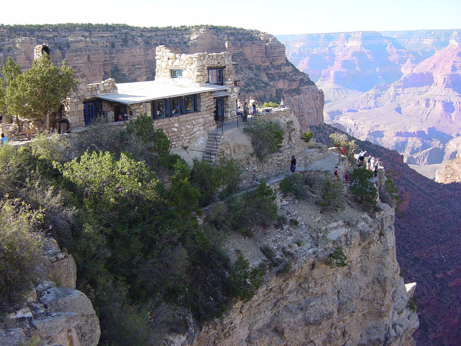
- Lookout Studio, designed by Mary Colter in a southwestern Native American style.
- The Grand Canyon Railway depot, one of the oldest standing wooden depots in the country.
- Bright Angel Lodge and the Buckey O'Neill Cabin, the oldest continuously standing structure on the South Rim.
The Bright Angel Trailhead marks the west edge of the district, 2.5 miles from Mather Point. The Village Route Transfer, where the Red Route bus to Hermits Rest begins, sits at this same west end. Our El Tovar Hotel guide covers the district's headline lodge in more depth.
Where the Parking Lots Are
Parking follows the same east-to-west pattern. The four lots at the Visitor Center Plaza fill by late morning during spring break, summer, and holidays. The park says drivers arriving by 10 a.m. in busy season can usually find a space. Each lot does a slightly different job:
- Lot 1 is closest to Mather Point and has pull-through spaces for RVs and trailers.
- Lot 2 is closer to the plaza, with no RV spaces.
- Lot 3 often works as the overflow lot, a short walk away, with no RV spaces.
- Lot 4 sits near the bike rental, café, and park store, with no RV spaces.
The village has its own lettered lots, and they often have room when the plaza lots do not. Lot A, across the street from Market Plaza, rarely fills completely. Lot B at Market Plaza is the largest and takes RVs and trailers. It may still fill by early afternoon. Lot C is a small lot in the middle of the village. Lot D sits near the Backcountry Information Center and often has space when others are full. Its southern section has pull-through spots for large rigs.
The practical move is to park once and stop using the car to get around. Circling Lot 2 at 11 a.m. is how a morning turns into a slow-motion hostage negotiation with a minivan. The shuttle system exists to end that.
How the Shuttle Routes Tie It Together
The free shuttles are the working Grand Canyon map for anyone without a car in the village. They connect the pieces that driving splits apart. The fall schedule runs September 12 through November 30, 2026:
- Village (Blue) Route: 7 a.m. to 9 p.m., every 12 to 15 minutes. It links the visitor center with the lodges, campgrounds, Backcountry Information Center, and Market Plaza.
- Kaibab Rim (Orange) Route: 6 a.m. to one hour after sunset. It runs east to the South Kaibab Trailhead and Yaki Point, and west to Mather Point and Yavapai.
- Hermits Rest (Red) Route: 8 a.m. to one hour after sunset, every 12 minutes, out to all nine Hermit Road overlooks.
- Hikers' Express: departures at 6, 7, and 8 a.m. from Bright Angel Lodge to the South Kaibab Trailhead.
The Tusayan (Purple) Route runs in summer only and is closed for the season. The park service also suggests a handy one-way walk. Ride the Orange Route between Mather Point and Yavapai, walk the rim, then catch the Blue Route back. Our sunset and sunrise viewpoint guide uses the same routes to chase the best light.
For a paper Grand Canyon map, the park hands out the South Rim Pocket Map and Services Guide at the entrance. It marks village parking, shuttle stops, and scenic overlooks. It belongs in the glove box, not wadded under a seat with the receipts. Pair it with the Rim Trail and the other South Rim listings on this site, then plan the day one zone at a time.